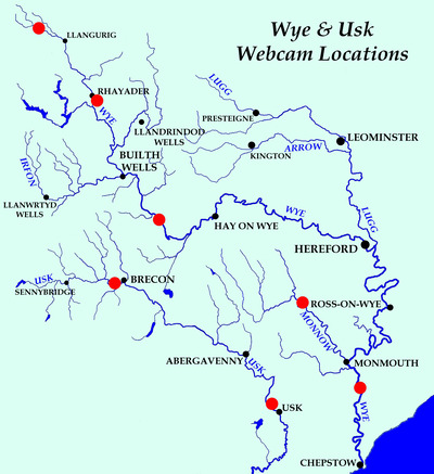
Welcome to the River Webcams and Weather section. Here you will find all the information you need to assess current and impending conditions.
Water Height and Colour
Each webcam shows a live image of the gauge at the top, with four images taken at set times of the day beneath. This enables you to compare the current height with those recorded earlier. Don't forget to update the page (press F5) if you keep it open. You will need to have a few trials to relate these heights to your own section of the river.
Some Wye and Usk gauges have a red marker indicating the height at which the canoeing spate clause is triggered. It needs to have been exceeded either on the current picture or one of the two a.m. pictures. There will be times when the gauge is completely covered.
Ideal river height for fishing is purely subjective. We encourage you to check water level on these pages before you go fishing to build up your own knowledge. Our gauges are in feet and inches but on some, an Environment Agency or Natural Resources Wales gauge is also shown, in tens of cm.
In addition to our webcams, the GaugeMap website is an excellent source of river height information.
Both the Met Office and BBC Weather sites show radar maps of rainfall. Use them to find out what has fallen or is about to fall in the catchments.